


NYC-Manhattan Community District 12--Washington Heights, Inwood & Marble Hill PUMA, New York
About
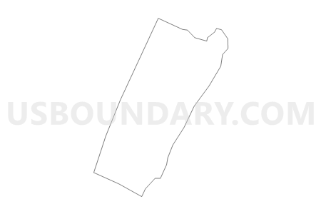
Outline

Summary
| Unique Area Identifier | 193474 |
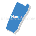
| Name | NYC-Manhattan Community District 12--Washington Heights, Inwood & Marble Hill PUMA |
| State | New York |
| Area (square miles) | 4.75 |
| Land Area (square miles) | 2.98 |
| Water Area (square miles) | 1.76 |
| % of Land Area | 62.83 |
| % of Water Area | 37.17 |
| Latitude of the Internal Point | 40.85864920 |
| Longtitude of the Internal Point | -73.93338180 |
Maps


Graphs
Select a template below for downloading or customizing gragh for NYC-Manhattan Community District 12--Washington Heights, Inwood & Marble Hill PUMA, New York


Neighbors
Neighoring Public Use Microdata Area (by Name) Neighboring Public Use Microdata Area on the Map
- Bergen County (East)--Tenafly, Park Ridge & Cresskill Boroughs PUMA, NJ
- Bergen County (Southeast)--Fort Lee, Cliffside Park & Palisades Park Boroughs PUMA, NJ
- NYC-Bronx Community District 4--Concourse, Highbridge & Mount Eden PUMA, NY
- NYC-Bronx Community District 5--Morris Heights, Fordham South & Mount Hope PUMA, NY
- NYC-Bronx Community District 7--Bedford Park, Fordham North & Norwood PUMA, NY
- NYC-Bronx Community District 8--Riverdale, Fieldston & Kingsbridge PUMA, NY
- NYC-Manhattan Community District 10--Central Harlem PUMA, NY
- NYC-Manhattan Community District 9--Hamilton Heights, Manhattanville & West Harlem PUMA, NY
Top 10 Neighboring County (by Population) Neighboring County on the Map
Top 10 Neighboring County Subdivision (by Population) Neighboring County Subdivision on the Map
- Manhattan borough, New York County, NY (1,585,873)
- Bronx borough, Bronx County, NY (1,385,108)
- Fort Lee borough, Bergen County, NJ (35,345)
- Edgewater borough, Bergen County, NJ (11,513)
- Englewood Cliffs borough, Bergen County, NJ (5,281)
Top 10 Neighboring Place (by Population) Neighboring Place on the Map
- New York city, NY (8,175,133)
- Fort Lee borough, NJ (35,345)
- Edgewater borough, NJ (11,513)
- Englewood Cliffs borough, NJ (5,281)
Top 10 Neighboring Elementary School District (by Population) Neighboring Elementary School District on the Map
Top 10 Neighboring Unified School District (by Population) Neighboring Unified School District on the Map
Top 10 Neighboring State Legislative District Lower Chamber (by Population) Neighboring State Legislative District Lower Chamber on the Map
- General Assembly District 38, NJ (222,394)
- General Assembly District 37, NJ (221,026)
- Assembly District 77, NY (126,463)
- Assembly District 71, NY (122,886)
- Assembly District 78, NY (121,803)
- Assembly District 81, NY (119,471)
- Assembly District 72, NY (117,394)
Top 10 Neighboring State Legislative District Upper Chamber (by Population) Neighboring State Legislative District Upper Chamber on the Map
- State Senate District 28, NY (321,361)
- State Senate District 30, NY (318,569)
- State Senate District 33, NY (314,246)
- State Senate District 31, NY (292,157)
- State Senate District 38, NJ (222,394)
- State Senate District 37, NJ (221,026)
Top 10 Neighboring 111th Congressional District (by Population) Neighboring 111th Congressional District on the Map
- Congressional District 16, NY (693,819)
- Congressional District 17, NY (678,558)
- Congressional District 9, NJ (661,379)
- Congressional District 15, NY (639,873)
Top 10 Neighboring Census Tract (by Population) Neighboring Census Tract on the Map
- Census Tract 245, New York County, NY (14,934)
- Census Tract 261, New York County, NY (12,087)
- Census Tract 291, New York County, NY (11,288)
- Census Tract 253, New York County, NY (11,236)
- Census Tract 279, New York County, NY (10,292)
- Census Tract 293, New York County, NY (9,033)
- Census Tract 263, New York County, NY (8,729)
- Census Tract 309, New York County, NY (8,463)
- Census Tract 269, New York County, NY (8,428)
- Census Tract 271, New York County, NY (8,196)
Top 10 Neighboring 5-Digit ZIP Code Tabulation Area (by Population) Neighboring 5-Digit ZIP Code Tabulation Area on the Map
- 10453, NY (78,309)
- 10468, NY (76,103)
- 10452, NY (75,371)
- 10463, NY (67,970)
- 10032, NY (57,331)
- 10031, NY (56,438)
- 10033, NY (53,926)
- 10040, NY (41,905)
- 10034, NY (38,908)
- 07024, NJ (35,353)